Hrauneyjafoss Power Station

1981Hydropower

Hrauneyjafoss Power Station came online on 21 October 1981 and is one of Landsvirkjun’s seven hydropower stations in the Þjórsá Area. Hrauneyjafoss Power Station is near the road Sprengisandsleið (F26) at the edge of Iceland’s highlands.

Third largest power station in the country

3 x Francis turbines

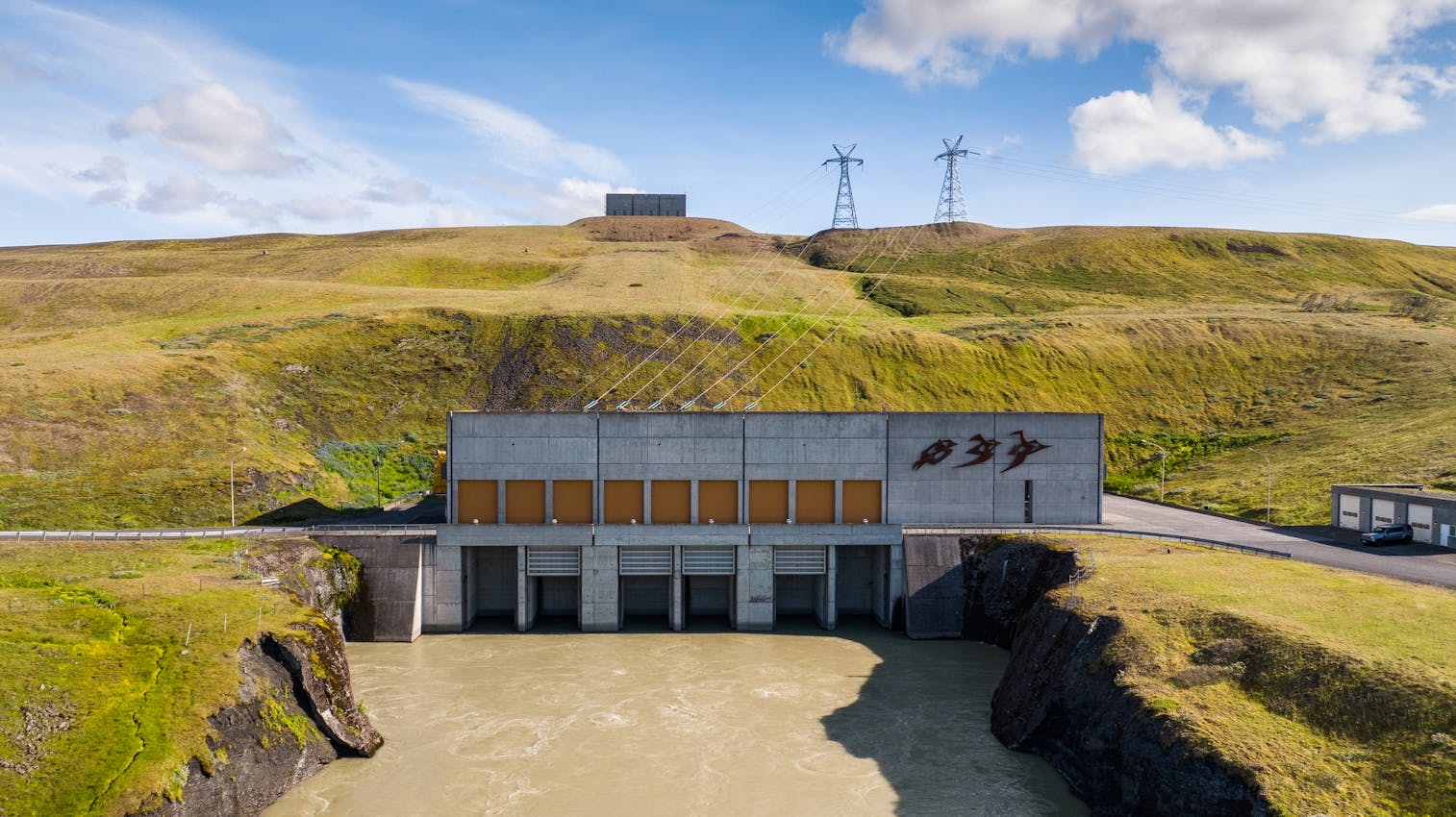
The Hrauneyjafoss Station is Iceland’s third largest power plant, producing 210 MW. It is located near the Sprengisandur Route on the edge of the highlands; southwest of the Sigalda Station, and utilises the same water as Sigalda Station. Hrauneyjafoss Station came on-line in 1981.

The Tungnaá River is dammed on rather flat land approximately 1.5 km above the Hrauneyjafoss Waterfall and 7 km below the Sigalda Station. The difference in altitude is approximately 15 m. Hrauneyjalón, an 8.8 km² reservoir, was formed by the dam. A low soil wall dam stretches along the lava flatlands on the south bank of the river. A headrace channel runs 1 km northwards from the reservoir through a dip in the Fossalda Hill to an intake point at its northern edge. Three steel penstocks (4.8 m in diameter) run 272 m down the hill to the powerhouse. The tailrace canal, just over one kilometre in length, enters the Spordöldukvísl waterway, which runs into the Tungnaá River.

Key numbers

  • Installed capacity

    0MW
  • Francis turbines

    0MW
  • Generation capacity

    0GWh /y
  • Total head

    0m
  • Maximum flow

    0m3/sec

Thjórsá and Tungnaá Catchment Area

There are six hydropower stations in the catchment area of Rivers Þjórsá and Tungnaá: Búrfell, Sultartangi, Hrauneyjafoss, Vatnsfell, Sigalda and Búðarháls, with combined energy of 1040 MW. Water for all the power stations is provided by three main reservoirs, Þórisvatn, Hágöngulón and Kvíslarveita, along with smaller reservoirs connected with each station.

Lake Þórisvatn, Iceland’s largest lake, is the largest reservoir and an important part of Landsvirkjun’s utility system. All water accumulated in Kvíslarveita and Hágöngulón reservoirs runs through Lake Þórisvatn.

Lake Þórisvatn became a reservoir with the harnessing of River Þjórsá at Búrfell Mountain in 1970-1972. River Kaldakvísl was diverted into the lake at the northern edge of the lake and a controlled outflow constructed at the southern edge.

A canal was dug from the lake and a concrete gate structure built in the canal to manage the flow rate. The canal is named the Vatnsfell Canal, and carries water from Lake Þórisvatn through the Vatnsfell Station into the Krókslón Reservoir above the Sigalda Station, and from there to other stations further down in the catchment area.

Work on the Kvíslaveita Reservoir began in 1980 and was completed in 1997. Kvíslaveita is the collective name for the dams, canals, bottom outlets and gate structures that manage the flow rate from the River Þjórsá and its tributaries into Lake Þórisvatn.

The Háganga Reservoir was constructed in 1997–1999 and covers an area of 37 km2. Its purpose is to increase the efficiency of the catchment area of River Kaldakvísl. During the summer months, water accumulates in the Hágöngulón Reservoir, with very little water flowing down the Kaldakvísl riverbed.